
|
THE FOLLOWING MAP IS NOT TO BE USED FOR NAVIGATIONAL PURPOSES.
|
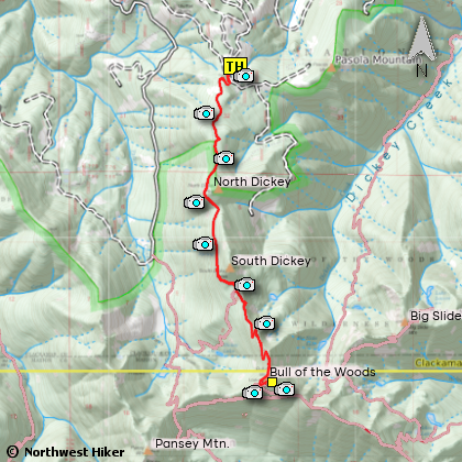
Length: 7 miles RT
Elevation Change: 1320' total elevation gain
Season: Early summer thru early winter
Difficulty: Challengingx
Permit: NW Forest Pass Required
Features:
This hike provides one of many ways to reach the Bull of the Woods Mountain Lookout.
In some ways it is the easiest, in that it just gently climbs along Dickey Ridge.
In early summer, when the bear grass is blooming, the hike is most rewarding. There
are no water sources along the route, so be sure to have enough drink with you.
Depending on the weather and clarity of the atmosphere, the views from the ridgeline
and of cuorse the summit can be specacular.
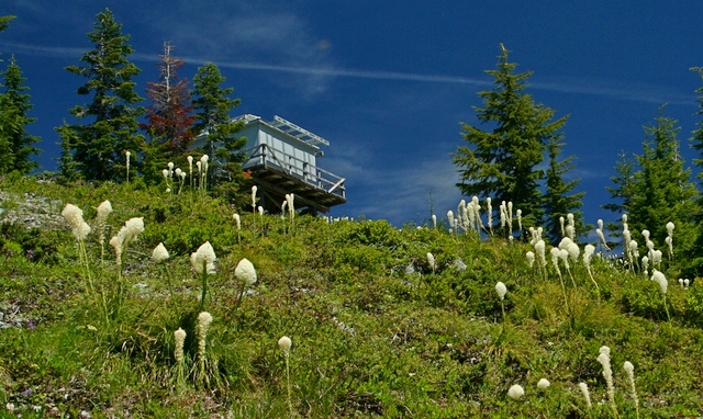
View of the lookout on top of Bull of the Woods Mountain
from the approaching trail
|
How to get there:
NEW!
Click for PDF Directions Map of this Hike
Follow Hwy 224 southeast of Estacada approximately 25 miles until it becomes
Forest Road 46 just after the Ripplebrook Ranger Station and the junction with
Forest Road 57. Continue south for about another 3.7 miles to the junction
with Forest Road 63. Bear right onto FR 63 and cross over the Clackamas River.
The road now follows the Collawash River for approximately 3.5 miles until you
come to the junction with Forest Road 70.
Continue on FR 63 for approximately 2.2 miles and on your right Forest Road 6340
will veer off and uphill. Follow FR 6340 for about 7.8 miles to the junction with
Forest Road 6341. Bear left, and continue to follow FS 6320 another 1.8 miles, and
you will see the trailhead sign and parking on the right side of the road.
|
|
|
A Virtual Hike of the Mount Hood National Forest


|
|